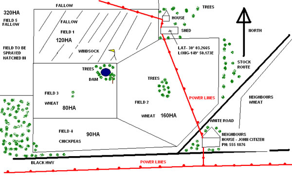
Client Mud Map
Client Mud Map Example
Good maps are crucial in identifying the treatment area and all the associated hazards and risks. It provides the information required to complete the job professionally and safely.
This map is a good example because:
- North is clearly marked on the top of the map
- Power lines are marked and labeled even outside the field
- Houses and sheds are marked including the neighbours house and contact details
- The fields are numbered and crops identified including nearby neighbours crops
- The size/area of the field is marked on the map
- Roads, dams, trees, windsocks and all other landmarks are clearly identified
- The treatment area has been clearly marked
- A lat and long has been provided
This information is used by the pilot to identify potential risks, hazard and susceptible crops, from this the safe application procedures can be organised in a more timely manner.